

Galilee Basin State Development Area
Declared in June 2014, the 105,996-hectare Galilee Basin State Development Area (SDA) comprises two 500-metre-wide corridors from the Galilee Basin to the Port of Abbot Point.
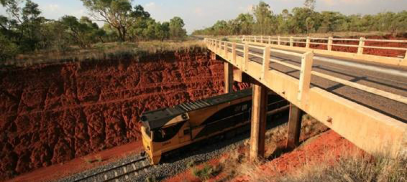
The Galilee Basin is a 247,000 square kilometre thermal coal basin in central Queensland. It is located about 200 kilometres west of the Bowen Basin, extending north past Hughenden, south to Charleville and west beyond Winton and Middleton.
The Galilee Basin SDA will support the development of the Galilee Basin and provide an efficient way to transport coal to the Port of Abbot Point- one rail corridor is designed to service the central Galilee Basin and a second corridor will service the southern Galilee Basin.
The SDA enables a coordinated approach to developing multi-user common rail corridors whilst minimising impacts on landholders and the environment.
The exact timeframe for development of the rail corridors is dependent on investment decisions made by private sector rail proponents.
Benefits of the Galilee Basin SDA
The Galilee Basin SDA and its associated development scheme:
- protects the geographic area where new rail infrastructure could be located
- controls development in an efficient way that considers existing industry and surrounding development
- provides proponents seeking to export coal from the Galilee Basin with potential access to rail infrastructure
- provides guidance and development certainty to industry
- minimises impacts on landholders and other stakeholders through the development of multi-user common rail corridors
- ensures development recognises and manages impacts to social, cultural and environmental values.
-
The Galilee Basin State Development Area Development Scheme (
 2.8 MB) is a regulatory document that controls planning and development within the Galilee Basin SDA.
The development scheme was approved by the Governor in Council in October 2015.
The development scheme contains a development assessment framework for making, assessing and deciding applications and requests relating to development within the Galilee Basin SDA. The most common is an SDA application for a material change of use (MCU). SDA applications for an MCU in the Galilee Basin SDA may be assessable or self-assessable, where the development can meet the self-assessable criteria.
The development scheme for the Galilee Basin SDA is supported by a public consultation policy (
65 KB) that provides information on matters the Coordinator-General may consider when determining whether public consultation of an SDA application is required. -
The Galilee Basin SDA regulation map (
2.4 MB) defines the boundary of the declared Galilee Basin SDA.The Galilee Basin SDA development precinct map (
2.6 MB) forms part of the development scheme and identifies the precincts within the Galilee Basin SDA.The Galilee Basin SDA has two precincts:
- a Rail Corridor Precinct to accommodate rail infrastructure and associated activities
- a Mining Services Precinct to accommodate uses that support resource activities and related development in the Galilee Basin.
The preferred development intent and a table which identifies regulated development in each precinct is outlined in the development scheme.
Detailed maps of the Galilee Basin SDA:
- Overview map ( 368 KB)
- Inset map 1 ( 608 KB)
- Inset map 1a ( 378 KB)
- Inset map 1b ( 229 KB)
- Inset map 2 ( 480 KB)
- Inset map 3 ( 266 KB)
- Inset map 4 ( 306 KB)
- Inset map 5 ( 222 KB)
- Inset map 6 ( 233 KB)
- Inset map 7 ( 255 KB)
- Inset map 8 ( 219 KB)
- Inset map 9 ( 205 KB)
- Inset map 10 ( 215 KB)
- Inset map 11 ( 213 KB)
- Inset map 12 ( 213 KB)
-
Since being declared, the Galilee Basin SDA has been amended. View previous versions of the development scheme:
- Galilee Basin State Development Area Development Scheme (November 2014) ( 3.9 MB)
- Galilee Basin State Development Area Development Scheme (June 2014) ( 1.3 MB)
Previous versions of Galilee Basin SDA maps:
- Galilee Basin SDA regulation map 2014 ( 2.9 MB)
- Galilee Basin SDA designation map 2014 ( 2.1 MB)
Detailed maps of the Galilee Basin SDA (June 2014):
- Index map ( 802 KB)
- Detailed map 1 ( 723 KB)
- Detailed map 2 ( 657 KB)
- Detailed map 3 ( 466 KB)
- Detailed map 4 ( 367 KB)
- Detailed map 5 ( 282 KB)
- Detailed map 6 ( 274 KB)
- Detailed map 7 ( 222 KB)
- Detailed map 8 ( 276 KB)
- Detailed map 9 ( 252 KB)
- Detailed map 10 ( 240 KB)
- Detailed map 11 ( 238 KB)
- Detailed map 12 ( 270 KB)
- Galilee Basin State Development Area Development Scheme (November 2014) (
-
The landholder relationship guide (
71 KB) sets out the state's expectations for the interactions between proponents of projects within an SDA and persons occupying land, or holding interests in land.
Further information
For further information on the Galilee Basin SDA, contact the Office of the Coordinator-General on 1800 001 048 or via sdainfo@coordinatorgeneral.qld.gov.au
Last updated: 02 Jul 2024