

Queensland Earth observation grant grows environmental management potential
Queensland Earth observation grant grows environmental management potential
Queensland's nation-leading Earth observation capability is set to grow following the recent establishment of the Queensland Earth Observation Hub, a partnership between the Queensland Government and the SmartSat Cooperative Research Centre.
The data obtained by satellite and drone technology contributes an estimated $3.3 billion per annum to the nation’s gross domestic product (GDP) and is being increasingly utilised by governments and businesses alike to make crucial management decisions plus harness new opportunities. Earth observation can, for example, enable us to predict extreme climatic events, or monitor urban developments and natural assets.
However, the processing and analysis of the extensive datasets obtained by this technology, poses a significant challenge for the industry. This is why funds from the Round One grants of the Queensland Earth Observation Hub are enabling specialist company EOMAP to develop a custom monitoring solution for Queensland’s coastline. Applications for the next round of funding are now open.
Queensland: Key market for EOMAP
As a world-leader in remote sensing, EOMAP has supported governments and industry on hundreds of projects identifying and managing ecological risk. The company, headquartered in Germany, specialises in aquatic Earth observation, working in both marine and freshwater environments.
Australia is arguably EOMAP’s single most important market, leading the Satellite-Derived Bathymetry (SDB) experts to open their first overseas office and establish EOMAP Australia on Queensland’s Sunshine Coast, six years ago.
Our clear atmosphere, fine weather with minimal cloud cover, vast size, history as early adopters of remote sensing technology and our indispensable coastline, make Australia ideal for aquatic Earth observation initiatives. As EOMAP Australia’s Managing Director, Dr. Magnus Wettle explains, “The coastline is just so critically important for Australia’s population.”
Partnership for success
The Queensland Earth Observation Hub is an initiative joint funded by the Queensland Government’s Department of State Development, Infrastructure and Planning, and the SmartSat Cooperative Research Centre.
EOMAP recently accessed the Hub’s Partnering Program grant, with funding of up to $300,000 available, designed to support industry-led projects with a commercial application, which involve at least one research and one industry partner. They have partnered with two of the state’s universities, the University of the Sunshine Coast, to utilise its expertise in coastal change, drones and in-field instrumentation, and the University of Queensland for the development of hydrodynamic models which will become predictive.
While EOMAP specialises in quantitative environmental information from satellites, it doesn’t possess the same level of experience in coastal change dynamics, drones and hydrodynamic modelling, which is why the research partnerships are beneficial.
“The Earth observation grant enables us to partner up with these specialists without taking on a lot of financial risk, [to] develop a market ready solution together with the forward-thinking end user, [Noosa Council]” says Dr. Wettle.
Dr. Wettle notes the grant provides the opportunity and support to make the project more efficient.
“Maybe we would have developed a scaled-down version of our project over the next three years and instead... we’re doing this now, properly, together, and in direct consultation with user requirements.”
 © Sharryn Kerrigan
Combating coastal change with COASTS
EOMAP’s endeavour to address the current lack of coastal monitoring data within the state, and thereby fill knowledge gaps in our understanding of coastal change, is aptly named COASTS – Coastal Change Observation and Analytics (multi-) Scale (multi-) Technology System. The state-of-the-art monitoring system will incorporate responses to storm events, which will facilitate coastal adaptation to climate change, and consequently build the state’s resilience to coastal hazards.
Mapping the 3D surface of the sea floor using satellite imagery is extremely difficult, yet important. This data can be used for navigational purposes, or to identify sediment underwater. Changes in the bathymetry indicate if sand is eroding, or if sandbars are moving.
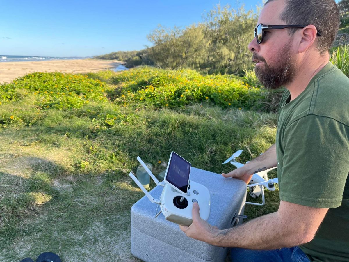
Drones are used to map fine detail in near real time, as well as to calibrate what is measured by satellites. Dramatic storm events or cyclones are not always immediately apparent on the sea floor, but drones and potentially beach cameras will be utilised in this project to monitor changes in sand - the terrestrial elevation at the shore, surface erosion, deposition and inundation. These factors are important for coastal stability. This method is much more efficient and safer than fieldwork such as actively boating to run sonar transacts.
Monitoring and mapping changes in coastal stability plus water quality in near real time, as well as tracking wind and water currents provides insight into these mechanisms and improves understanding of ecological systems. The scale of the data is broad, from satellite turbidity data collected in 10m grids, to drones capturing 1cm of beach. These layers of data are combined to produce modelling for analysis.
The project partners’ novel approach will leverage satellite imagery, drones, numerical modelling, artificial intelligence-based analytics and cloud-based portal technology. Comprehension of this combined information will lead to the development of tools for costal processes, hazards and beach safety. Such applications will empower Queensland to become resilient to coastal change.
While we can’t yet predict what the project will reveal about Noosa’s coastline, Dr Wettle believes the decision-making outcomes will be positive. “I feel pretty confident that having more fit-for-purpose geospatial data and thereby understanding of the system... it’s going to help manage coasts.”
Commercial Applications
The grant funding has made this Earth observation project more accessible to Noosa Council, with only limited investment required from the local government. The Council will benefit from this collaboration between three experts in three fields, with an application designed specifically to monitor coastal hazards in Noosa.
While EOMAP’s data portal systems will effectively be the backbone of COASTS, the purpose of the project is not to examine the data in isolation.
The portal will have user-specific analysis functions, which enable changes in bathymetry to be calculated on the fly with modelling components. Bathymetry can be combined with turbidity maps, to identify if there are turbid outflows from Noosa River which can be connected to the modelling component, together with wind and wave data. Ultimately, this will enable site-specific predictive modelling.
Dr. Wettle explains it is the analysis which is meaningful to users, in this instance Noosa Council, which drives consumption of Earth observation technology. “If you can do some relevant analysis on it, some analytics that are meaningful to users, then that’s what really is going to drive the consumption of observation data.”
“It’s a matter of bringing it all together into this application-specific solution.”
In future, this functionality can then be taken to other councils and agencies looking for coastline monitoring solutions.
Queensland’s vulnerable coastline
Queensland’s 13,347km coastline is vulnerable to change, as Dr. Wettle explains, “We simply have increasing population along Queensland’s coastlines and its low-lying sandy areas – they're really vulnerable to wave erosion, climate events... with the backdrop of climate change.”
The state’s $23 billion tourism industry relies heavily on our pristine beaches and reefs. The vital role of Earth observation in the management of these natural assets has been evident since the 1980s, when CSIRO developed software for mapping the Great Barrier Reef. Coincidentally, Dr. Wettle’s study of remote sensing of tropical coral reefs are what led him to relocate to Australia.
“[Noosa Council] is keen to develop a system that allows them to monitor essentially coastal change and what’s called coastal hazards,” says Dr. Wettle.
The Council will identify three critical sites which will be the focus of initial system development, which will combine the land and water interface. “It’s everything, so to speak, both terrestrial components of the beaches as well as what’s underwater, and where the rivers and oceans meet.”
The EOMAP project aims to provide information on changes in near real-time, including where something seems to be eroding, or needs to be protected. “The modelling can be used to predict what [are] vulnerable areas. I think that’s really important,” says Dr Wettle.
This importance extends to infrastructure planning, as Dr. Wettle explains, “if you’re able to get a handle on... what are the future inundation or coastal erosion risks. That would be pretty important before you invest in a new development.”
“If we subscribe to climate change being underway... adaptive management is needed.”
Applying for the next round of Queensland’s Earth observation funding
The potential for Earth observation projects to influence the future of our state is extensive. Dr. Wettle cites such diverse applications as identifying certain spectral signatures across deserts to prospect for minerals, or mapping non-compliant changes made to residential properties.
Reflecting on EOMAP’s COASTS successful project proposal serves as a timely reminder for applications in the second round of funding offered by the Queensland Earth Observation Hub. Funding is available in three categories; a partnering program, mobility scheme as well as calibration and validation projects. Submit your Earth observation project application before the deadline – 5pm, Monday 26 September, 2022.
Last updated: 06 Nov 2024