

How digital twins can help us plan a better Queensland
How digital twins can help us plan a better Queensland
No matter where you look, development is underway across Queensland. With Queensland facing unprecedented changes in population, international profile and climate, there are significant opportunities to improve and future-proof Queensland’s infrastructure.
Imagine if you could predict, and plan for, current and future infrastructure using technology and data in the smartest ways possible. One of these ways is the use of digital twins.
What is a digital twin?
Digital twins are a digital representation of the real world; a virtual model that is the exact replica of a physical thing. This ‘reality capture’ could be a machinery part, high-rise building, rail line, tunnel, or even an entire city.
Reality capture is just what it sounds like. From the ground or the air, special cameras capture multiple images of an object or area of interest from different perspectives. Computers then overlap these images and combine them with known third and fourth dimensional coordinates. The eventual result is a fully detailed, high-resolution, spatially accurate 3D or 4D model.
Digital twins can be used for engineering and planning, real-time monitoring, stakeholder and community engagement, and to model changes, trial new ideas and test innovations without affecting a live service through simulation, machine learning and reasoning.
Looking at the digital twin can give viewers an exact understanding of how the physical twin is performing in the real world. It also provides a way to predict the impact of future events.
It has been said that “a digital twin without a physical twin is a model”, but in fact a digital twin can exist before its physical partner.
As a case in point, Australia’s most advanced digital twin was built to model the design and planning of Brisbane’s Cross River Rail. The digital twin modelled 300 square kilometres of Brisbane to support the largest piece of public transport infrastructure ever built in Queensland.
3D reality modelling developed for the Cross River Rail project in 2018. Video courtesy Department of Resources.
A history of digital twins
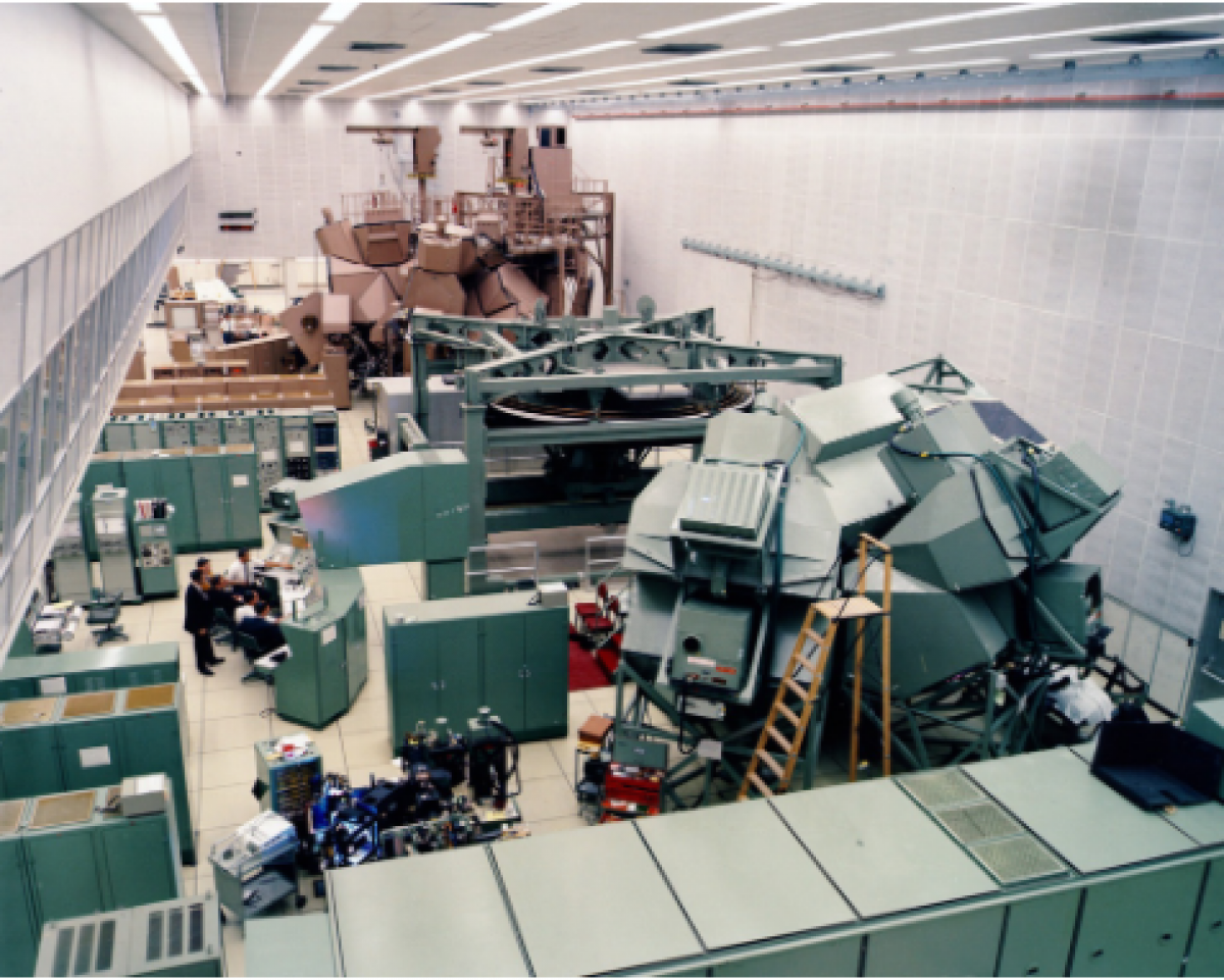
The concept of a digital twin (then known as a “living model”) was developed by NASA for use in their Apollo missions of the 1960s – and in the case of Apollo 13, avoiding absolute disaster when an on-board oxygen tank exploded.
Using simulators controlled by a network of digital computers (taking up a then-whopping 256 kilobytes of common memory!), NASA was able to simulate “live” critical mission situations. As such, all three astronauts aboard Apollo 13 famously made it back to earth safely.
Since then, digital twins have become a powerful tool in everything from rebuilding the fire-damaged Notre Dame Cathedral, creating a real-time competitive edge in Formula One racing, to allowing local citizens to breathe life into neglected urban spaces using Minecraft.
Helsinki in Finland has one of the world’s longest-running digital twin programs, and today uses the city-wide data it produces to reduce carbon, improve city services and promote innovative development.
How can digital twin technology be used?
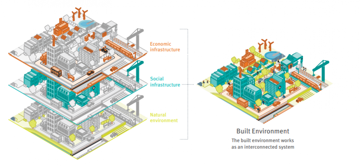
Digital twinning enables governments to capture past, present and future infrastructure plans and projects into a single platform, allowing everyone to visualise accurate and coordinated data to make timely and informed decisions and achieve greater outcomes for communities.
This would support more effective land use and infrastructure planning, infrastructure delivery, sustainability and emergency response, and transparency in community engagement and communication in the longer term.
The advantage of coordinated digital twins speaks directly to the aims and ambitions of the Queensland State Infrastructure Strategy, which identifies infrastructure as an interconnected system comprising economic, social and environmental factors.
The value of data sharing
With the huge amount of data comes a responsibility to use it well, to share it intelligently, and to plan for its use.
In Queensland, the Department of Resources is the lead agency for managing data resources – including location data, spatial data and georesources data. The agency also manages cadastral data, also known as cadastre.
This data includes location, value, tenure and ownership of parcels of land. This data is shared via a range of mapping applications to support business, industry and the community, and is the key ingredient for digital twins.
The Centre for Digital Built Britain, a project that sought to digitise the entire life cycle of all Britain’s built assets, estimates the data and intangible assets produced by a digital twin to be worth half as much as the physical asset it represents.
Moreover, good data management leads to better Sense Making - that is, environmental, social, financial and corporate governance and modelling, which in turn leads to better decision-making, and improved quality of life for those these decisions impact.
Good information management means increased productivity, economic growth and value to customers, society and the environment. “Better decisions faster” means better outcomes for people, profit and the planet.
To support this idea, the Australian and New Zealand Land Information Council developed a set of principles to help industry, government and the research sector generate data and develop digital twins in a coordinated way. The principles draw on the Centre for Digital Built Britain’s Gemini Principles.
Find out more below:
Twins at work
Data from digital twins can be useful for many groups to better plan, design and manage our cities, including:
- Planners
- Infrastructure Owners
- Developers
- Policy makers
- and residents
With proper security measures in place, digital twinning can deliver immense value to relevant stakeholders through making data available clearly and resiliently.
Data sharing can also be used to plan for, prevent and assist with recovery from natural disasters and climate change, as well as to identify and manage ecological risk.
Supporting a digital future
Digital twins are emerging as a leading tool to present a more comprehensive understanding of the world. A Queensland digital twin workbench could provide a data-powered digital replica of our built and natural environments, effectively integrating geospatial, transport, infrastructure and other data in real time to support efficient development and planning for our growing state.
Stay tuned for more developments in this exciting space.
Further Sources:
- https://www.resources.qld.gov.au/data-mapping
- https://amses-journal.springeropen.com/articles/10.1186/s40323-020-00147-4
- https://www.ibm.com/blogs/internet-of-things/iot-cheat-sheet-digital-twin/
- https://www.csiro.au/en/research/technology-space/robotics/digital-twin
Last updated: 08 Apr 2025